.post-body a:has(img) { display: flex; justify-content: center; } Small Thoughts

Saturday, May 17, 2014

Big Ride - Day 1

Day 1. I left home early to catch a ferry over to Whidbey Island as part of my plan to not ride on an interstate today. Success! Hardly anyone on the ferry, either. The ride north to the border was moist - just a steady heavy mist.

The border crossing at Sumas was empty. I was the only person headed into Canada and it took about a minute. The Canucks are way more accommodating than we are. I have never had to do anything more than answer a few obvious questions when headed into Canada. Crossing back into the US usually entails removing my helmet and explaining why I would possibly want to come home. The line to cross into the US was a couple of blocks long.

Weather improved for my ride across the first part of British Columbia. A lot of those miles were spent riding through E. C. Manning Provincial Park. Imagine one of our  national parks with a four lane highway through the middle of it and you have it about right. Unfortunately, scenery was in short supply because the clouds were persistent. So even though I stayed dry for a while, I didn't really see much.

Driving in Canada is pretty much the same as driving in the US. Speed limits are a lot lower - max speed on a 4 lane highway was 100 km/h (about 62 mph), and it wasn't unusual to have a limit of 80 km/h. It took a little while for me to realize my GPS unit had already translated km/h into mph and posted a suitable limit for me. Yay! The other interesting thing is they seem to be very conservative in how they post corners speed recommendations.

The second half of the ride was wet enough to choke a frog. I have good gear, but no amount of gear will stop complete immersion for any length of time. A drysuit would have been a better option. Everything survived except my gloves - those were absolutely drenched! I have two extra pairs but it seemed pointless to swap out that close to the end of my ride. It took 10-15 minutes for my hands to dry out when I stopped for dinner.

All-in-all, an OK day of riding. I tallied 449 miles. I had planned to do more, but the rain made me tired a little quicker and so I cut out a few stops to get to my room a little quicker. Tomorrow is supposed to be a little less wet, and it is a little longer day of riding, too. I am off to Lethbridge, Alberta tomorrow.

E. C. Manning Provincial Park

One of my bonus stops today. It had just started to rain and my gloves were still mostly dry.

My last bonus stop of the day. My gloves are completely saturated and very hard to get on and off. Must be time for pizza and beer.

Thursday, May 15, 2014

Almost Ready!

I leave on my ten-day motorcycle trip this Saturday. I think I have taken care of all the things that are going to trip me up - I have my passport and a Canada insurance card. I am really looking forward to this trip and hope to update this blog each day with highlights from the day's riding. The motorcycle gods are not being totally nice to me in terms of weather, but it should be OK. It has been sunny and warm here all week, but the weather changes to typical spring-time Pacific Northwest weather on, you guessed it, Saturday! As long as it isn't snowing I am going.

I have set up a trip on Spotwalla. For those of you not familiar with this free service, it captures GPS data from your compatible device (a Spot device in this case) and keeps a map up to date with your current location. I normally use the device to make sure Jeannette knows I am OK, but thought it might be interesting to be able to see where my trip takes me. The link below will take you to a real-time map of my location (transmitted every ten minutes). Save the link or click it each time - shouldn't matter. It won't start populating my map until my trip begins Saturday morning, though.

Link to my Spotwalla page.


I was really hoping my trip would be mostly like this...

But I will be pretty happy if I don't spend too much time waiting like this...

Thursday, April 3, 2014

Planning A Long Motorcycle Trip

What to pack, where to go, how long to ride each day? All questions faced when planning an extended ride like the one I have planned in May. Part whimsy, part retirement present to myself - this trip will cover about 3,500 miles over 10 days with stops in southeast Idaho to visit longtime friends and Reno for a banquet for one of the rallies I am completing this year.

When I decided to go on this ride I knew it would be a challenge to narrow down where I wanted to go. I have ridden all over Washington and Oregon in search of dams, airports and random checkpoints for my rally adventures. I would say there is little of those two states I haven't seen, in fact. Surrounding states are more of a motorcycle mystery to me. I have ridden briefly in Idaho, Montana, Northern California (note the capitalization like it is an independent state), and a snippet of British Columbia. I wanted two things out of this ride - to visit friends in southeast Idaho and to ride through southern Canada. Those constraints pretty much dictated the rest of my ride plan. I am very excited!

I am a planner. I am the guy who knows how far he will drive and where he will stop every night. I have taken the less planned route and tried the camping routine before. I enjoyed it but was riding with friends on that trip. Not sure the camping part would be as much fun without the friends. The trick for me is to limit the planned distance each day to allow for frequent stops for hydration, snacking and random photo stops. While I have found that I can ride over 750 miles in a single day, about 400 miles a day is a much better long ride strategy for me.

I used Booking.com to set up my hotel stays. I decided to try to stay in smaller mom-and-pop style places where possible. Yelp has also been a good resource to look at the possibilities. Since I am new to Booking.com, I have tried it out a few times on some shorter over night trips with good success. Some of my friends mentioned nightmare scenarios with this website, but I haven't had any problems so far. I have one more overnight ride planned in April and will test the site one more time. Fingers crossed, especially in Canada!

Here's a screenshot of a loosely planned route I have mapped out. Each letter represents my planned stop for the night. I am especially excited about two days spent in southern Canada. That section of road is supposed to be some of the most beautiful riding. I am also very excited about another trip through Glacier National Park. A full day in Idaho will be spent catching up with long-time friends, Eric and Jodi. Minden, NV is the location of the banquet I am attending. The trip across Nevada will be on America's loneliest highway - US-50. The last two days will be spent returning home in the interior of California, Oregon and Washington.

I tried to minimize time spent on interstates as much as possible.


My planned route during the week leading up to Memorial Day weekend.
I suppose my biggest concern is weather. I know that snow can fall along most of my route anytime into early June - in fact, I have personally seen snow on July 4th in Idaho Falls. I will be watching the weather very carefully as my trip approaches. Rain is OK - snow and ice are not.

I have included some pictures of rides and stuff I have done so far this year. I bought a new bike (a '14 Yamaha FJR 1300) last November and have been riding the heck out of it! I have signed up for three rally events so far this year.

  • Big Money Rally: a points based rally where you ride to a location described in a handout and take a picture of your bike with a placard at that location. Nationwide event that runs from January 1st to Memorial Day weekend. This is the banquet I am attending.
  • Oregon Airport Tour: picture event where you ride to any of 10 small airports described in a handout and take pictures of your bike at the airport.
  • Wing Washington: picture based event where you ride to locations described in a handout and take pictures of your bike at that location.
Although my personal favorite (Dam Tour) was discontinued a few years ago, there are a few die-hard Dam Tour riders who continue the tradition by picking some dams and riding out to them. I participate as much as I can.

I will post updates as my trip approaches, and will try to update while on the road, too.
This isn't motorcycle related - just an obligatory picture of the area behind my house.

Stopped for a picture on a beautiful day along Oregon's coast.

Pine Hollow dam in northern Oregon.

This is one of the airports I am planning to visit - Hood River, OR. The goal is to get out and ride!

Example of one of the Big Money Rally bonus locations. This theme was library. Had to have the bike, the placard and the library signage in the shot.

Another of my airport trips - Florence, OR.

One of my stops for a stretch and picture taking. This is looking down on the US-97 bridge over the Columbia River.

Another example of a Big Money Rally bonus location. This one was described as a "Castle House" and the picture had to be taken from the correct perspective, too.

Tuesday, November 26, 2013

Motorcycle Pursuits

My New Ride!
Why would I trade in my beautiful BMW R1200RT for a new FJR? Many reasons. I admit to lusting after this bike since I read a review of the electronic suspension variant earlier this year. I elected to buy the model without electronic suspension, mainly because I rarely changed anything meaningful on my BMW. I am hoping the Yamaha will cost less to maintain, and that it will cost less if something does go wrong. The only real complaint I had with my BWM was the cost of maintenance.

Some other things I already like about the FJR:

- The gas tank is metal. Why is that important? Because my magnetic tank bag will work on it. The BMW had a plastic tank and a funky attachment system. The BMW tank bag was several hundred dollars, thus i never got one.
- The FJR has a few more horsepower - like about 40 more! That really isn't too important to me since I never really felt like I used everything the BMW had. But now I can brag? And the bike does have two settings - touring and sport - so I can take it easy in the touring mode and it is a much more manageable power delivery.
- I can't lie - I love the way the black rims look with the dark red color.

I signed up for the Big Money Rally again this year. This rally starts January 1st, runs through Memorial Day, and involves taking pictures of landmarks throughout the US with your bike in the picture. I did the rally last year and attained finisher status. With my upcoming retirement and plans to take leave for the last couple of months in the Navy, I should have plenty of riding opportunities. I plan to write a little about my trips this year.

Monday, July 15, 2013

Hiking Mt Townsend

Danny and I are planning to hike to the summit of Mt St Helens later this month and decided to use a hike up Mt Townsend as preparation. I recently bought a new pack and wanted to try it out before heading up. It was a pretty nice day and we were on the road before 8 to top off our tanks at a local restaurant. There are literally hundreds of day hikes within about 2 hours of our house, so an early start isn't always necessary.

The trailhead is at the end of about 15 miles of single lane forest service roads - some paved and some not paved. It was a little nerve racking and made me miss my truck a little bit as I felt my car bouncing through dips and over bumps. We made it to the smallish parking area at around 10 and headed up.

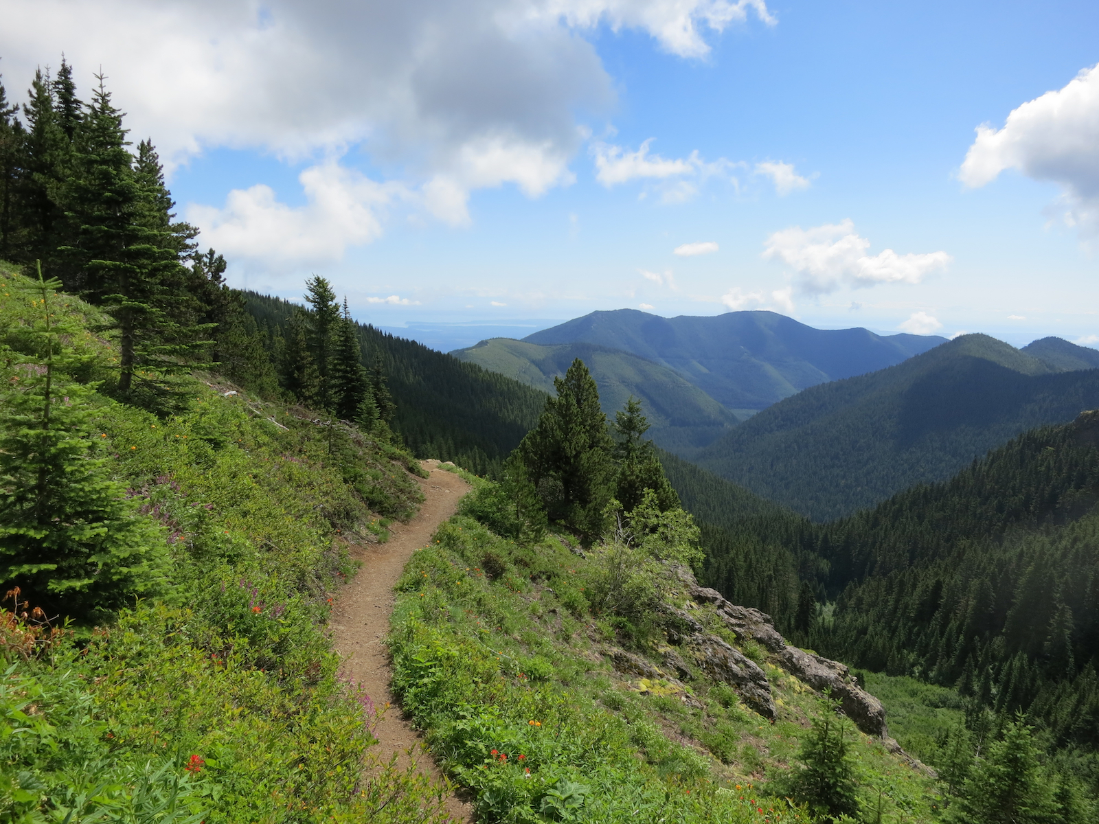
The trail starts out very steep as it winds through forested land in the Buckhorn Wilderness area. I imagine many less prepared people turn back because of the somewhat daunting start to the trail. It is well maintained and easy to follow but somewhat steep. After rising about 1000 feet in the first mile the trail becomes more manageable and settles in to a series of about 24 switchbacks as it works its way up the remaining 2000 vertical feet over about 3 miles. The views into the Quilcene valley are pretty amazing as you wind higher and higher - even Danny gave it a serious compliment when he said "this doesn't suck." Wildflowers were in full bloom along the trail for the first couple miles. The last half mile is brutal as you seem to climb straight up to the summit at 6280 feet.

We spent some time at the top taking pictures, eating a snack and trying to decide if we wanted to hike the additional mile to the lesser summit on the north side of the mountain. We elected to not go out there and instead began our descent. The hike up took us about 2 hours and the hike back down took about 1.5 hours. For me, the hike down is always more painful on my knees. I recently bought some trekking poles and that was a big help. Also brought some ibuprofen with me, and that was a bigger help.

All in all, a very good day. Mt Townsend is about 8.2 miles round-trip (4.1 out and 4.1 back) with a roughly 2900 foot elevation gain. Mt St Helens will be a 10 mile round-trip with a 4500 foot gain. I am expecting some awesome pictures from the summit, and we are taking some good company with us to Mt St Helens - our friends Mike and Ken.

Looking back down the trail into the Quilcene Valley.

Wildflowers were in full bloom along the trail.

Another look into the Quilcene Valley from higher up the trail (we were at about 5200 feet here).

On the summit, looking back at the approach trail with the Olympic Mountains in the background.

On the summit looking north towards Canada.


On the summit, looking towards the Olympic Mountains and Olympic National Park.

Wednesday, July 3, 2013

More Reasons To Love the PNW!

One of the things I like most about Washington is the ability to visit multiple national parks and national forest areas in a day trip. Mt Rainier National Park, Olympic National Park, North Cascades National Park, Mt St Helens National Monument and several very good state parks are all within a couple of hours of our house. We have been successful convincing the other 49 states that it rains 364 days a year, so the parks are typically not too crowded unless you go to the obvious tourist stops on the obvious visiting days.

Olympic National Park is a gem. The way the park is situated on the Olympic Peninsula creates several distinctly different smaller parks. Rain forests, mountains, river valleys - you want it, you got it. I have not spent enough time up there in the past and plan to change it this year. I only have a couple more years with my hiking buddy in the house so I have to make the best of it.

I visited two of the parks this past weekend. On Friday I went hiking in Olympic NP with Melissa and Danny in the Staircase area. On Sunday I went for a ride through North Cascades NP on my bike. Both days were fantastic, although Sunday verged on being too hot. I have found that I can comfortably ride in temps up to 90F with all my gear on as long as I stay moving. Anything above that and I get too hot. I saw temps at 100F on Sunday - thankfully not the entire ride!

Looking upstream of Enloe Dam in north central Washington.

Washington Pass in North Cascades National Park. The weather was warm verging on hot!
Looking out on North Cascades National Park from near Washington Pass on US 20.

A photo op in North Cascades National Park.
Our hike on Friday was great! It is pretty easy to get to the trailhead at Staircase. A nice drive that includes about 10 miles of well maintained gravel ends at a ranger station with ample parking. We went a little over a mile out and then turned around. A nice picnic lunch wrapped up the day.

Skokomish River tumbles down rapids near Staircase in Olympic National Park.


And I thought I had moss problems on the roof of our last house!

Skokomish River inside Olympic National Park.

Lake Cushman near where the Skokomish River enters.


Tuesday, June 25, 2013

A Ride North (and West)

I have always wanted to visit the most northwest part of Washington - Cape Flattery. I have seen the lighthouse several times from the ocean while transitting in and out of port on submarines but had never seen it from land. It takes effort to get up there because it isn't on the way to anywhere else. You have to want to be there. The area is part of the Makah indian reservation. I finally made time to ride up and do a little sight-seeing this past weekend. It helped that a couple of checkpoints on my summer riding rally were nearby - that finally gave me the reason to go. It was a beautiful day in the PNW with almost impossibly good conditions on the coast - mid-60F temps, few clouds and very little wind. I did hit one road block on my ferry ride. The tide was so low that a couple of sailings were cancelled. Luckily it was easy to hang out in the sun and enjoy a nice day. Next time I will check the sailing alerts on my phone app.

Low tides cancelled a few sailings between Whidbey Island and Port Townsend. Lots of sun and a coffee shop made it bearable :)
The coastline near Cape Flattery was beautiful!

Looking south from the Cape Flattery trail.

Looking out at the Cape Flattery lighthouse. It sits on an island a couple of miles offshore.
All three kids made it home for a few days after school was out for the summer. It was nice to have them there, even if only for a few days. Stephanie had a chance to bond with Wilson but had to go back to Bellingham for work. Melissa is home for a few weeks before she heads back to Seattle to work this summer. Danny is off this summer but keeping very busy with running, cross country camp and reading assignments for his AP classes next year. And he had his braces removed!

Danny without braces!

Melissa was home for a few weeks.

Stephanie bonds with Wilson by walking him on the trail behind our house.

Our deer friends are back :)