Monday, May 26, 2014

Day 9 - Homeward!

Sunday was supposed to be a ride from Minden, NV to Bend OR with a few stops to look at restaurants, dams and airports. I took off at 5 am with a full belly and gas tank. Thank goodness for 24 hours casino restaurants! Riding with an empty stomach and without my morning coffee just doesn't return as much fun. It was cool but not cold and I decided to leave my heated liner in the bag thinking it would warm up quickly when the sun came up. Wrong! It was fine through Reno and north a little bit, but it got downright cold as soon as I crossed into California on US-395 and the sun came up! A quick stop to change out gear and I was moving again.

I took a long route north to enjoy California's many excellent motorcycle roads. Twisty and scenic, it is probably one of my very favorite places to ride. Traffic was light and I was making very good time, even without speeding excessively. By lunch time I was at my first stop at a little place called Max's Cafe in Keno, OR, just across the border from California and in the area known as the Klamath Basin. I had enjoyed views of Mt Shasta for a couple of hours and really enjoyed the area. I continued west towards two other checkpoints, Pinehurst State Airport and Emigrant Lake Dam, and found myself pretty close to I-5. Knowing that the weather was going to be bad both days near home, I made the decision to push towards home and try to avoid Memorial Day traffic headaches.

It wasn't an easy decision. I have ridden high mileage days in the past, but always mentally prepared for the event. This time my mind was prepared for about 600 miles, and I was changing my plan and would be covering close to 900 miles. I decided to do it and made it safely home at around 10:30 pm after only 3 hours in the rain. Traffic was light and I made good time, so I think it was the way to go. It also solidified in my mind that I can accomplish one of my goals for the summer and complete an Iron Butt Association sanctioned Saddle Sore 1000 - ride 1000 miles in a 24 hour period. The event is an individual ride with documentation required (like witnesses, gas receipts, etc). If I had thought it out a little better, and had all the paperwork with me Sunday, I could have added a few miles and knocked it out! Oh, well.

So my ride is complete and it was fantastic! I saw some areas of the country that I wanted to ride through and met some really fantastic people at the rally banquet in Minden. The ride totaled nearly 4,000 miles over 7 riding days - a respectable 566 miles/day. Throw out yesterday and it was a more realistic 510 miles/day. I think a few weeks off are in order to allow my brain and bank account to recover!

Mt Shasta from the Klamath Basin in northern California.

Lower Klamath Basin in northern California.

Obligatory bike shot.

Pinehurst State Airport - one of the checkpoints for a different tour :)

Emigrant Lake Dam near Ashland, OR.

Friday, May 23, 2014

Day 7 - Minden, NV

Day 7 is in the books, and I have made my way from Ely, NV to Minden, NV (near Reno). It was just about as perfect as you could possible want with very few clouds, no rain and light winds. It did get a little warm as I got closer to Reno.

Today's main goal was to capitalize on the whorehouse bonus. I talked about a bad experience in Wells the night before, but nothing weird happened today. In fact, the places got much more upscale closer to Reno, and the only interaction I had with "employees" this time was a few offers to take my picture. After 46 years I can now say I have seen the Mustang Ranch - it was a mythical mecca when I was in high school in northern California.

Riding across Nevada requires creativity to break up the boredom. After climbing a pass within minutes of leaving Ely this morning, I decided to stop at every pass marked by a sign on highway 50. The total was 10, and they ranged from a piddly 6,400 feet to a more impressive 7,600 feet. I was decked out in my heated gear but didn't really need it. Pass temperatures were around 50F, even at 8 in the morning. In fact, the first pass was warmer than it was in Ely!

Finally, several of the rally riders got together for dinner in town tonight. I had a great time meeting some of the faces behind the helmets. There is a pretty strong contingent from Washington state - more than I would have guessed. I was surprised that so many traveled quite a few miles to be here.

We get together for the rally banquet Saturday afternoon and evening. I don't plan to ride too far Saturday morning - I am going to take advantage of the break to rest. Sunday morning I start my trek home and hope to be back sometime Monday afternoon, traffic permitting.

I left Ely and climbed to this pass within about 15 minutes.

Looking back to the east, these were the last clouds I saw for the rest of the day.

I have to think the people responsible for naming mountain passes ran out of motivation for this one.

One of my whorehouse bonus pictures. The $5 bill was a required element for this special bonus.

9 of the 10 passes from today's ride. Sorry not all the signs are visible.
My route so far. I plan to ride back through California, eastern Oregon and western Washington.


Thursday, May 22, 2014

Day 6 - Ely, Nevada

Day 6 is in the books. I successfully made my way from Rigby, ID down to Ely, NV without ever putting a tire on an interstate. I guess the closest I came was on the short stretch of highway from Eric's house to Idaho Falls that was 4 lanes. We will look the other way.

Riding through this section of Idaho and Nevada requires patience. Not because of slow traffic - more because the scenery is pretty consistent. There are breaks, but it looks a lot alike for most of the trip. The trick is to admire the raw beauty. You have to remember to enjoy it.

My first real stop of the trip was at Craters of the Moon National Monument. Jeannette and I lived in Idaho Falls for a while in the early 90s, and we made the trip out to the monument once. Except we never actually made it! We saw lave flows and stopped, admired, and turned back around. This time I made it to the visitor's center and drove through the 7 mile loop. Simply put, it was stunning. I wish I could say my pictures do it justice, but my poor iPhone just couldn't quite capture all of the detail.

Next stop - Twin Falls (of Evil Knievel fame). I came in to town from the north and crossed the Snake River on highway 93. It looked like a good stop. The bridge and surrounding bluffs are about 700 feet above the river. While I was there admiring the scene I stopped to talk to an older gent who was watching the river. He pointed out a group of people packing parachutes and preparing to jump off the bridge. It is not illegal to jump and seems to be a popular spot for thrill seekers. I watched two young men walk out to the center and jump off. It was pretty dark cool.

After Twin Falls came Jackpot, Nevada. I encountered the only rain of the day crossing the pass into the Great Basin and into Wells, NV. Wells is the location of one of the new themes on my motorcycle rally - whorehouses. The idea is to ride to as many Nevada whorehouses as possible and take a picture with my motorcycle and placard. I was pretty sure this theme would set me up for embarrassment, and it only took one stop to set up an awkward situation. The stop I made was at Donna's Place. No problem. There was a second house (not on my list) right across the parking lot from Donna's. Several girls from the other house saw me at Donna's taking a picture and started to walk over to see if they could entice me to their business. Imagine how a hooker would dress for work and you pretty much have it right. Then imagine Tim quickly putting his gloves back on and getting the heck out of there!

The other place's name was Bella's. I had a restaurant on another one of my excursions that was named Bella's, and I really hoped that was not a restaurant in addition to a whorehouse! Thankfully there was a restaurant on the other side of town, and it had no affiliation.

Wells is also home to the biggest and meanest group of free-range dogs in the world. I clocked one of them at about 30 mph as he ran next to me waiting to see if I would poop my pants. I managed to escape. I have had my fill of Wells, NV!

The ride down through the Great Basin into Ely, Nevada was very pretty. Unfortunately the sun was in the wrong place for pictures. I am hoping to have better picture luck tomorrow.

Tomorrow's ride is across Nevada on highway 50 into Reno. Should be a pretty spectacular day.

This is officially the middle of nowhere in Idaho. I believe those are the Sawtooth Mountains.

Obligatory national monument sign picture :)

Craters of the Moon

Craters of the Moon

Craters of the Moon

Looking down on the Snake River in Twin Falls, ID.

Small people on the center of the bridge getting ready to jump.

Afetr the jump and thank goodness the chute opened!

Donna's Place. My least favorite stop so far!

This dude followed me all day long :)


Wednesday, May 21, 2014

Day 4 - Southeast Idaho

Day 4 was a much nicer day for riding. Not much rain, very little wind and comfortable temperatures. I enjoyed it! My route for this leg of the trip started in Kalispell, MT and wound through the Flathead Valley. Many of my stops for the day were located in small Montana towns off the beaten path. I know Montana is a large state, but you don't get a sense of how big it is until you are thinking about where the next gas stop will be. After a stop for breakfast at a small restaurant in Bigfork, MT, I was gassed and ready to ride.

My GPS unit has a neat feature that lets you select "curvy" roads. I used it for this leg and it didn't disappoint. A winding route through the Lewis and Clark National forrest took me to Helena, MT and beyond. From Helena I used an interstate for the first real time this trip to make my way down to Butte. I have tried to avoid interstate riding, but this leg had an actual destination (Eric's house) and I didn't want to be too late. More back roads into West Yellowstone, MT were fantastic!

I had been through the area around West Yellowstone before and decided to use the same route into the town. My route took me throughout the area known as Earthquake Lake. This lake was formed when an earthquake brought a bunch of the landslide down and formed an earthen dam. Pretty cool area. The highlight of the day happened on my way through this area when an RV I was following stopped suddenly. Anyone familiar with national park travels will know what that means - wildlife! I was not disappointed as a group of about 6 bighorn sheep sauntered by about 10 feet from me on the side of the road. No pictures (I was riding after all), unfortunately.

West Yellowstone is a very different town before the tourist season ramps up. It was kind of desolate and hadn't quite freshened up from what must have been a rough winter. I am sure they will get it put together. I had to stop at the park sign for an obligatory picture.

After leaving town, it was mostly smooth sailing into Rigby, ID for the night. I had to pull over and wait out a few storms. I have decided that if I see lightning, I am done! I still managed to pull in to Eric and Jodi's before 8.

All-in-all, a good ride. I am staying with them for the day so no riding on Wednesday. I am off Thursday on my way to Ely, NV. No interstates, of course.


Picture perfect day along Swam Lake south of Kalispell.

One of the courthouse bonus pictures from Boulder, MT.

Unbelievable beauty from the high plains to the west of Yellowstone.

Looking upstream towards the earthen dam that holds back Earthquake Lake.

Obligatory national park picture :)


Monday, May 19, 2014

Day 3 - Kalispell, MT

Day 3 is in the books. It started in Lethbridge, AB and ended after a full day in Kalispell, MT. No more border crossings for this guy (for now).

After learning my lesson about when border crossing stations open, I planned my departure to arrive at the crossing on the border of Glacier National Park right on time at 8 am. Unfortunately, that particular gate didn't open until 9 am! I guess I could have researched it on the web, but I was tired the night before. And I thought 8 am would be perfect. I got there right on time. I spent my free hour walking around a bit and then trying to find a place that was secluded from the persistent wind. Wind would be the theme of the day.

After mastering yet another border crossing, I was headed south into Montana. It was a pretty nice morning with clouds but no rain. But the wind. Oh, man, the wind. It was blowing 20-30 mph ALL DAY. You feel it in a car, but you really feel it on a bike. It is tiring and annoying. And when it does rain, it helps blow water past clothing that would normally protect you quite well. And I learned a new lesson today:

- Rain hurts at 70 mph. Hail hurts worse.

I was traveling to some dams around Great Falls and a line of storms approached. Having already seen the outcome of that kind of weather when we took a family vacation in South Dakota a few years ago, I decided to cut my dam hunting a bit short and seek shelter. Just as I pulled in to a covered gas station the heavens opened. It lasted about 30 minutes and I was off again.

The ride through Waterston Lakes and Glacier was awesome! I must go back when it is a bit warmer. In fact, the entire day of riding was pretty nice in terms of scenery. I included a few pictures below.

I have to say I am very happy with my hotels so far. Tonight's stay is at the Kalispell Grand Hotel in downtown. Walking distance to several good restaurants (and beer), nice room, neat ambience. Booking.com has done well for me so far.

Well, I am off to Rigby, ID tomorrow morning to see long-time friends Eric and Jodi. I will take Wednesday off from riding to visit with them - I can tell you my butt is looking forward to the break. And then it is off to Nevada and the loneliest highway.
I had plenty of time to compose my pictures since I had the wrong opening time (again!). This is on the Canada side in Waterston.

Obligatory national park sign.

And again, but this one is for 'Murica.

The penguin claims Cut Bank is the coldest spot in the nation. What about Alaska? Oh, you mean the nation of 48? OK, Penguin.

Ryan Dam near Great Falls, MT.

My hotel for the night - the Kalispell Grand Hotel.


Sunday, May 18, 2014

Day 2 - Lethbridge, Alberta

Day 2 started off very nicely. The rain stopped overnight and I was able to walk around a little while I waited for the only breakfast place in town to open. I successfully positioned all of my wet clothing near the heater and it was ready to go. I was the only person at the restaurant that early in the morning until a group of motorcycle riders came in to eat. We were able to chat some and I found out that they were out riding off-road trails and lived in Calgary. After talking to them a while, I learned the first important fact of the day:

- The Canadian police can confiscate your bike if they catch you exceeding the posted speed limit by more than 40 km/h! I don't generally speed, but it is not hard to hit 40 over if you are passing a slowpoke. Good to know.

Breakfast was good (blueberry pancakes and scrambled eggs), and conversation with the owner was also good. With my belly filled up, off I went.

I decided to backtrack a few miles and cross the border into Washington to pick up a quick bonus picture. That is when I learned the second important lesson of the day:

- Many of the small border checkpoints do not open until 8 am. If you arrive at 7:30 am, expect to wait for 30 minutes. At least it wasn't raining!

I had very good success with border crossings today until my final return into Canada. I guess I somehow flagged their system, or possibly it was just a random inspection, but the last crossing stopped just short of a cavity search. They even had me remove my seats to check for contraband. Now I admit, after a full day of riding, my wild hair and smushed up face makes me look suspicious, and I wouldn't have been surprised to have the US agents do an inspection. But the Canucks? Really?

Highlights of this day of riding included Libby Dam in western Montana, the ride north into Canada and over the Crowsnest Pass, and a brief stop at what the Canadians claim is the world's biggest truck. I can't argue their claim, but my truck is pretty big, too :)

On my way back into Canada, I learned important lesson number 3 for the day:

- My tank has about a gallon left when the fuel light thingy comes on. That is about 45-ish miles. The nearest gas was close enough, thank goodness.

Finally, in the middle of nowhere outside Lethbridge, I encountered what I think the Canadians could fairly claim was the longest train in the world. I got to the crossing in time to see the locomotives go past, and then waited for almost 20 minutes to see the last car go by. And it was moving at a pretty decent clip, too.

After all that excitement, I arrived in Lethbridge uneventfully a little after 9, even after losing an hour due to a time-zone change that I had forgotten about. It was a very good day! Tomorrow I head south back into Montana and loop around Glacier National Park into Kalispell, MT.

Stats:
577 Miles Today, 1026 Miles Total

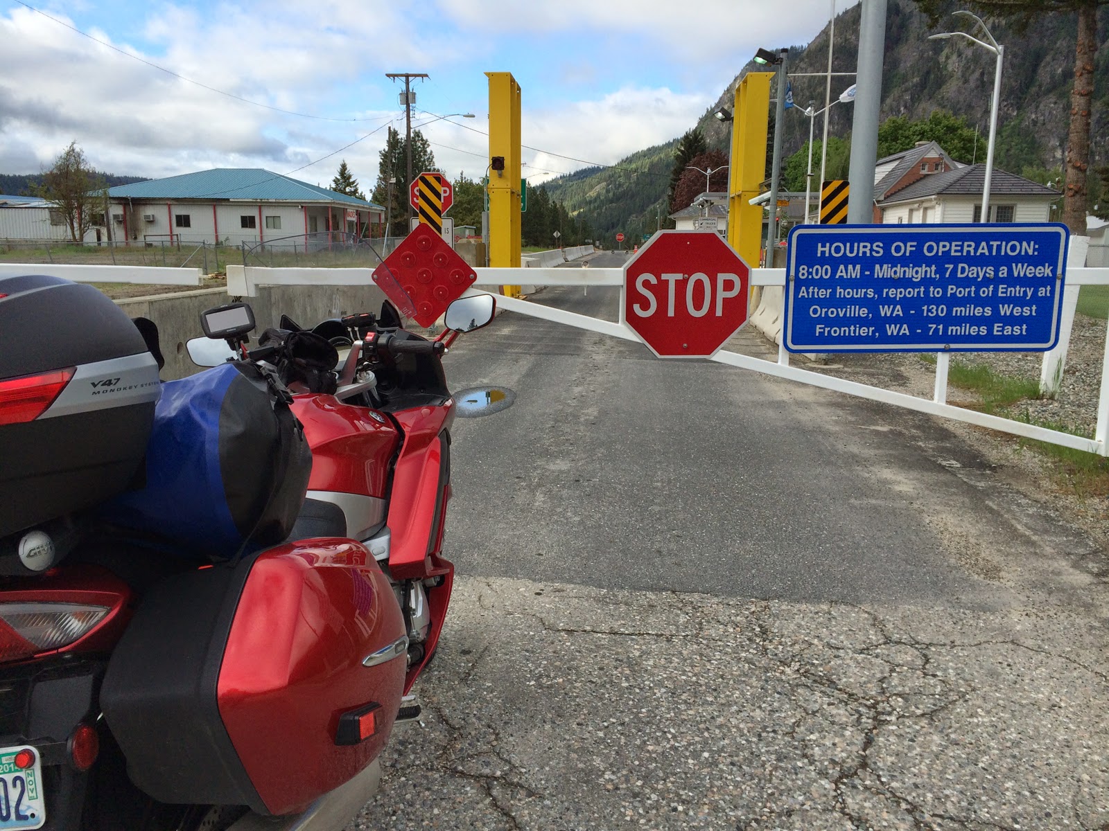
I was first in line. Because everyone else probably knew it didn't open until 8 am.

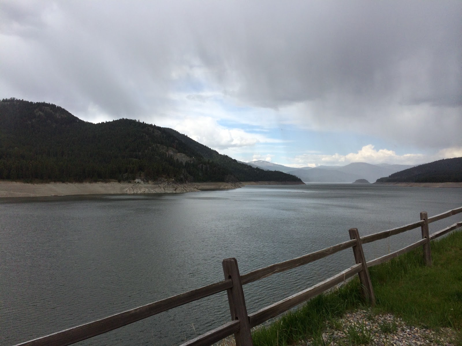
Looking out over the reservoir formed by Libby Dam in Montana.

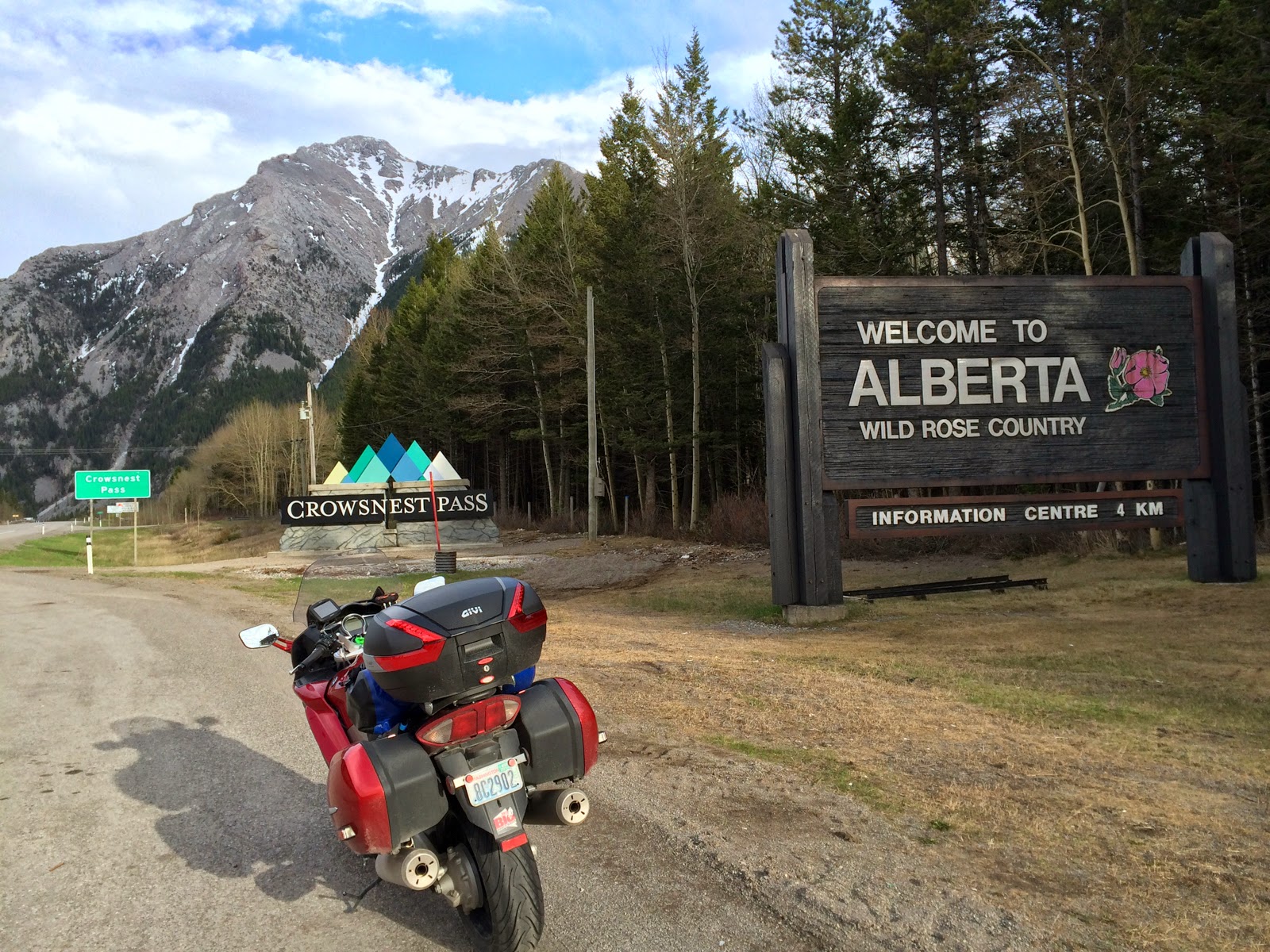
I have arrived in Alberta, Canada.

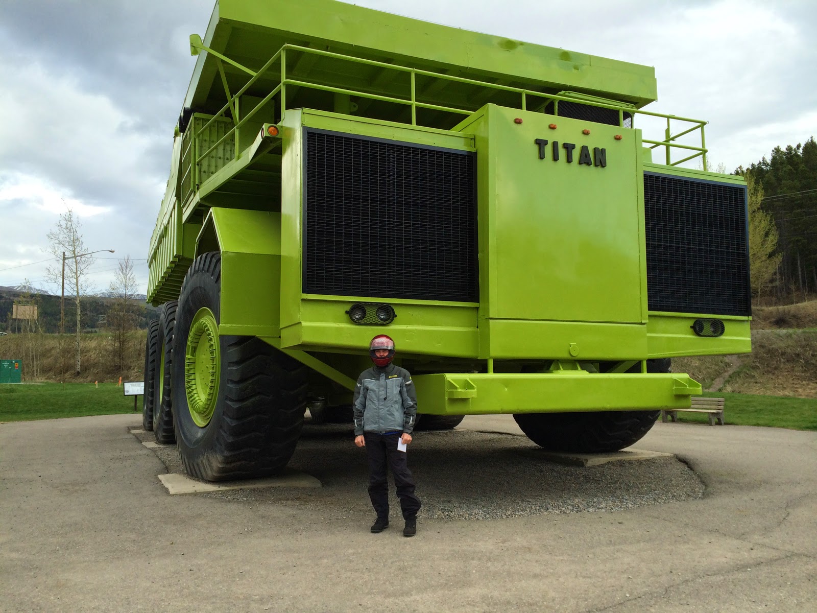
The world's biggest truck.

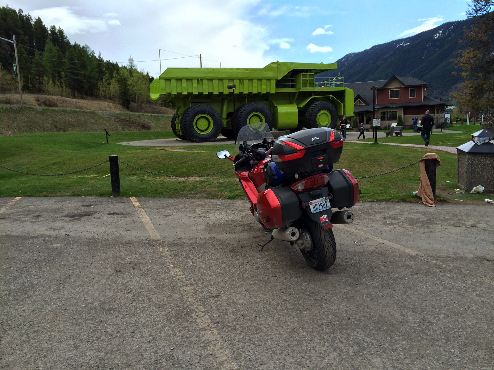
Not so big compared to my FJR, though.


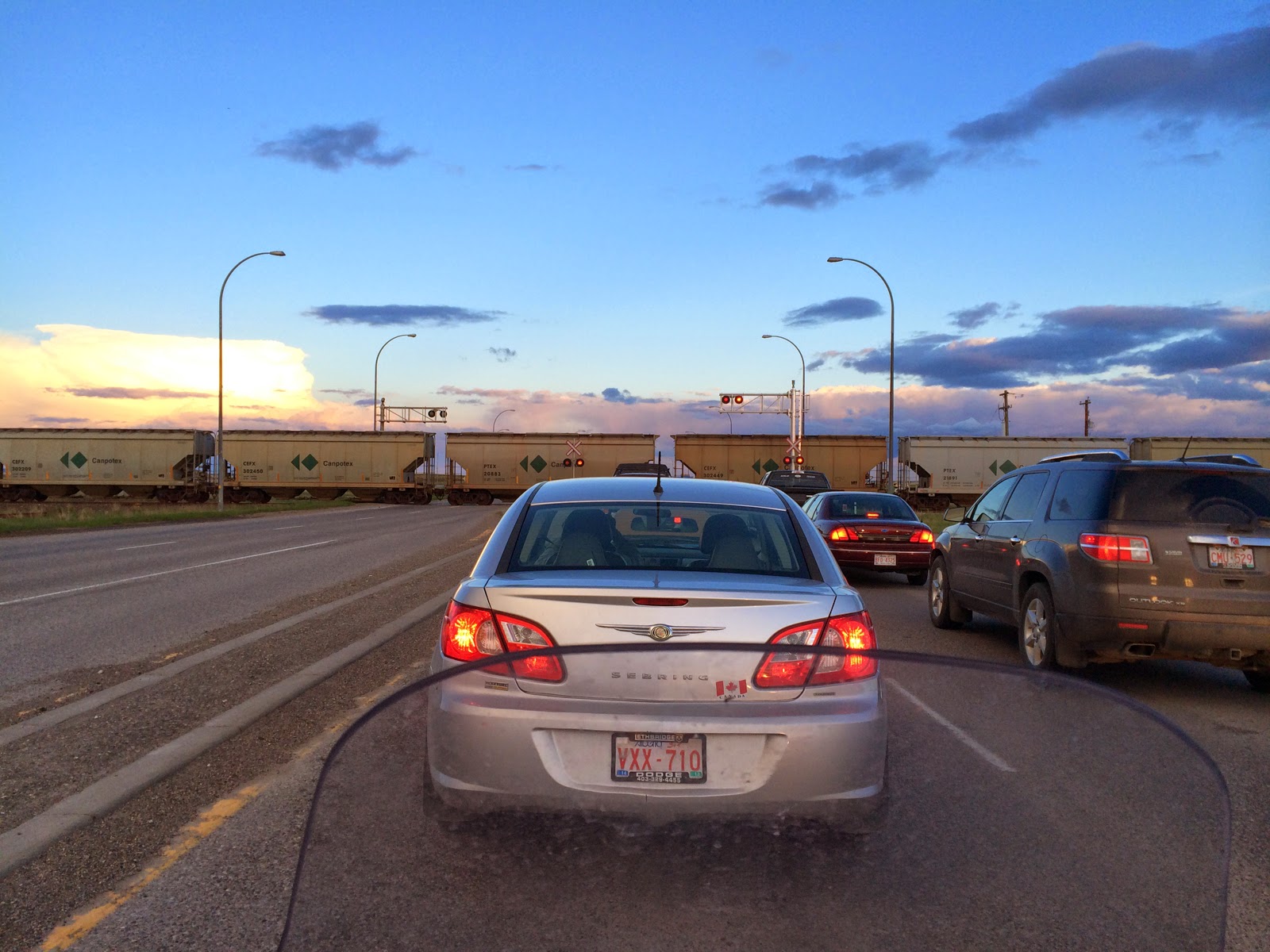
Train crossings in the middle of nowhere are like a red light for me. No matter where I am, I am never disappointed.

Saturday, May 17, 2014

Big Ride - Day 1

Day 1. I left home early to catch a ferry over to Whidbey Island as part of my plan to not ride on an interstate today. Success! Hardly anyone on the ferry, either. The ride north to the border was moist - just a steady heavy mist.

The border crossing at Sumas was empty. I was the only person headed into Canada and it took about a minute. The Canucks are way more accommodating than we are. I have never had to do anything more than answer a few obvious questions when headed into Canada. Crossing back into the US usually entails removing my helmet and explaining why I would possibly want to come home. The line to cross into the US was a couple of blocks long.

Weather improved for my ride across the first part of British Columbia. A lot of those miles were spent riding through E. C. Manning Provincial Park. Imagine one of our  national parks with a four lane highway through the middle of it and you have it about right. Unfortunately, scenery was in short supply because the clouds were persistent. So even though I stayed dry for a while, I didn't really see much.

Driving in Canada is pretty much the same as driving in the US. Speed limits are a lot lower - max speed on a 4 lane highway was 100 km/h (about 62 mph), and it wasn't unusual to have a limit of 80 km/h. It took a little while for me to realize my GPS unit had already translated km/h into mph and posted a suitable limit for me. Yay! The other interesting thing is they seem to be very conservative in how they post corners speed recommendations.

The second half of the ride was wet enough to choke a frog. I have good gear, but no amount of gear will stop complete immersion for any length of time. A drysuit would have been a better option. Everything survived except my gloves - those were absolutely drenched! I have two extra pairs but it seemed pointless to swap out that close to the end of my ride. It took 10-15 minutes for my hands to dry out when I stopped for dinner.

All-in-all, an OK day of riding. I tallied 449 miles. I had planned to do more, but the rain made me tired a little quicker and so I cut out a few stops to get to my room a little quicker. Tomorrow is supposed to be a little less wet, and it is a little longer day of riding, too. I am off to Lethbridge, Alberta tomorrow.

E. C. Manning Provincial Park

One of my bonus stops today. It had just started to rain and my gloves were still mostly dry.

My last bonus stop of the day. My gloves are completely saturated and very hard to get on and off. Must be time for pizza and beer.

Thursday, May 15, 2014

Almost Ready!

I leave on my ten-day motorcycle trip this Saturday. I think I have taken care of all the things that are going to trip me up - I have my passport and a Canada insurance card. I am really looking forward to this trip and hope to update this blog each day with highlights from the day's riding. The motorcycle gods are not being totally nice to me in terms of weather, but it should be OK. It has been sunny and warm here all week, but the weather changes to typical spring-time Pacific Northwest weather on, you guessed it, Saturday! As long as it isn't snowing I am going.

I have set up a trip on Spotwalla. For those of you not familiar with this free service, it captures GPS data from your compatible device (a Spot device in this case) and keeps a map up to date with your current location. I normally use the device to make sure Jeannette knows I am OK, but thought it might be interesting to be able to see where my trip takes me. The link below will take you to a real-time map of my location (transmitted every ten minutes). Save the link or click it each time - shouldn't matter. It won't start populating my map until my trip begins Saturday morning, though.

Link to my Spotwalla page.


I was really hoping my trip would be mostly like this...

But I will be pretty happy if I don't spend too much time waiting like this...

Getting Ready For Our Canary Island Cruise

  Canary Island Itinerary We are preparing to depart on our long-awaited Canary Island cruise with friends! We fly into Lisbon, Portugal and...